History of the WHR: 3 - The Route Described
© Copyright 1990 Alun Turner & the Welsh Highland Railway Ltd.

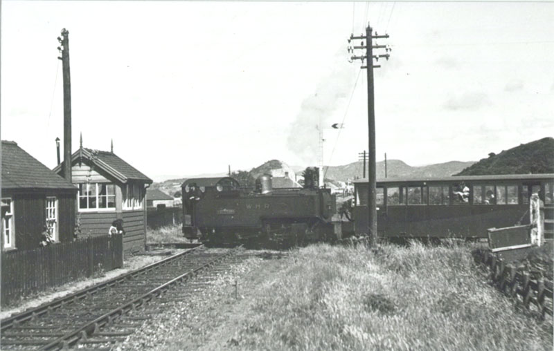
Dinas Junction - Tryfan Junction
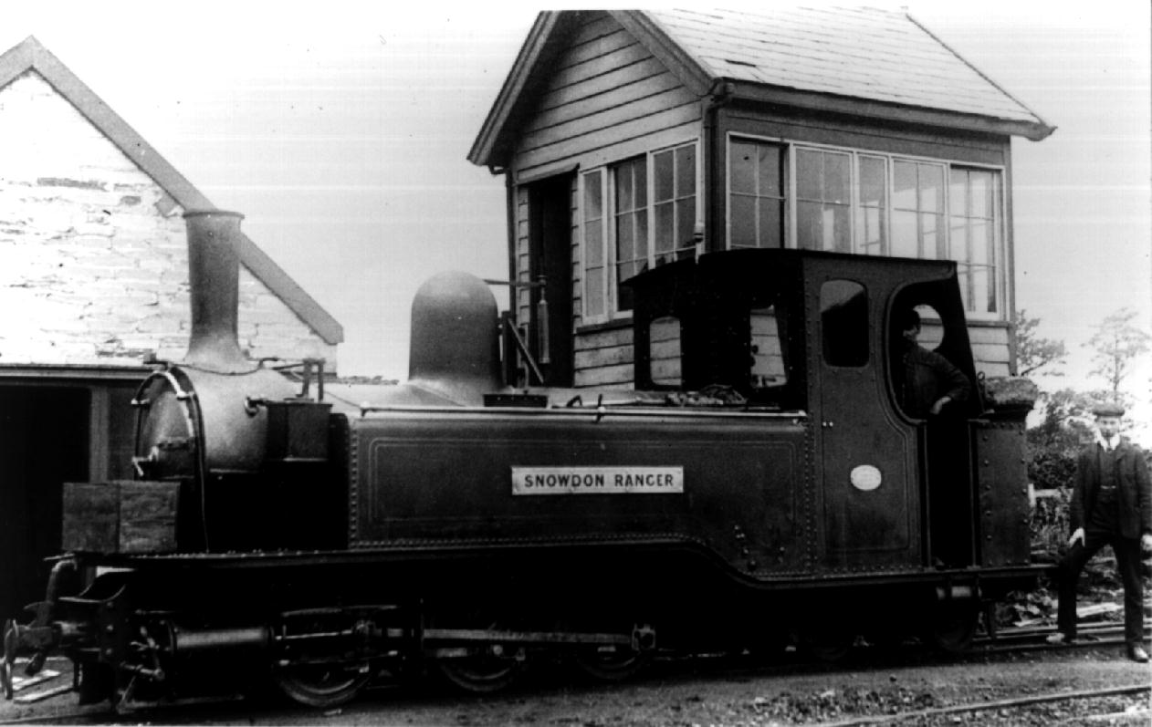
<div class="figcaption"><em>Snowdon Ranger</em> at Dinas Junction, June 1909.</div>
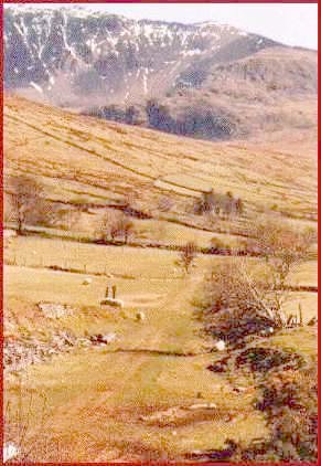
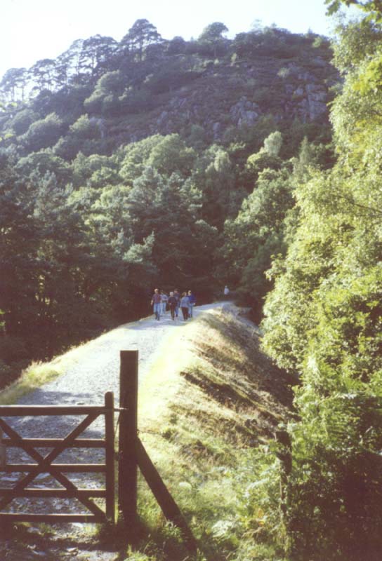
Dinas Junction is situated on the former Bangor to Afon Wen branch of the L.N.W. Railway which, like the Welsh Highland, has had its track lifted and the trackbed is now in use as a road, a cyclepath and medium distance walk, with other parts either built over (as with Chwilog station site) or left to grow wild. At the north end of the station stood the goods shed and transhipment sidings. The passenger station lay between the standard and narrow gauge lines and consisted of a wooden refreshment room, a stone built station building and a small wooden hut which served as a booking office. As befitted its importance, a station master's house was also built. An overbridge carried a minor road across the lines of both companies at the south end of the station and to the south of this bridge were narrow gauge locomotive and carriage sheds, a water tower and a signal box. The overbridge still stands today and visitors can look down on the site today from the bridge onto the current scene of industrial activity.
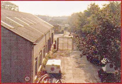
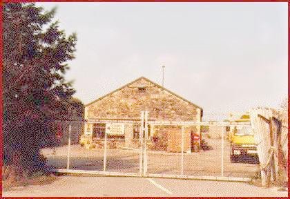
<div class="figcaption">Site of Dinas Station, 1995 (views north & south)
<span class="credit">(B.J. Fisher)</span>
</div>
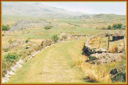
Leaving Dinas in a southerly direction, the line swung to the left into a cutting and passed under the main Caernarfon - Pwllheli road, the cutting on the south side of the road having been filled in as recently as 1989. Climbing at 1 in 47 though open countryside, the line crossed the Gorfai, a small stream, on a wrought iron girder bridge and passed under two minor roads, whilst crossing the Gorfai twice more before reaching Tryfan Junction (2 miles). Here was a passing loop, a wooden signal box and a station building of stone construction. It is worth noting here that all the station buildings of the old North Wales Narrow Gauge part of the line were of stone construction, representing the optimism under which the line was built. In contrast all the buildings on the newer section of the line south of South Snowdon Station (and on the former Croesor Tramway section) were all of corrugated iron or even more temporary construction, possibly reflecting the more cautious feeling prevailing at the time the Welsh Highland was built.
The Bryngwyn Branch
The Bryngwyn branch immediately diverged to the right of the main line and turned through 180 degrees to run behgind the station and back in the opposite direction to the main line. The gradient in this section started as 1 in 39 but eased down to 1 in 49 as Rhostryfan Station (3/4 mile) was reached. The station consisted of a stone station building, a signal box and one siding with a goods shed at its end.
Leaving the station, the line entered a cutting and then crossed a small stream before passing under the main road through a village and within 50 yards crossed a minor road on the level to head up through open countryside once again on slight embankments and cuttings to enable it to use the natural contours of the hill. The line then crossed the Bryngwyn road on the level and immediately the gradient becomes 1 in 39 as it entered another cutting on a 180 degree curve emergin on an embankment. It then curved back the other way, round Bryngwyn Farm, and crossed the Bryngwyn road again on the level. Immediately across the road lay Bryngwyn station (2 1/4 miles). Here was a signal box beside the level crossing gates, a stone station building, a goods shed, a run round loop and a siding. Set someway away from the station stood an explosives store.
For the passengers, this was the terminus of the branch, but beyond the station stood the incline and the real purpose of the branch. The incline was of double track and rose from 650ft above sea level to 895 ft over its half mile length. Unlike most similar railways, the Welsh Highland owned the incline up to the drumhead and the private tramways did not start until beyond that point. Here four branches converged, leading off the The Alexandria Slate Quarry, The Moel Tryfan Slate Quarry, The Fron Slate Quarry, and The Braich Slate Quarry. Looking back from the top of the incline, the line's starting point at Dinas could be seen some 2 miles away whilst the line had covered over twice that distance in reaching here.
Tryfan Junction - Plas-y-Nant
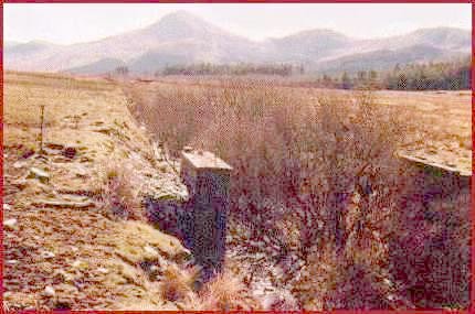
Back at Tryfan Junction, the main line climbed away at a gradient of 1 in 690 curving towards the east and passing under a minor road before running on a high embankment to reach the summit of this section and then starting to descend at 1 in 200 into the Gwyrfai Valley, running on a shelf on the valley side with the Afon Gwyrfai coming ever closer to the line as it descended. The line now passed under the Caernarfon to Beddgelert road and into Waunfawr station (3 3/4 miles). Here was another stone station building, a passing loop and a siding and a short branch line to a granite quarry. There was also a signal box, not used in Welsh Highland days but dating back to its North Wales Narrow Gauge predecessor.
The line continued alongside the main road, on a gentle climb of 1 in 150, and reached Bettws Garmon station (4 1/2 miles) where there was the obligatory stone station building which still stands today, although derelict, a passing loop and a siding which crossed the Caernarfon to Beddgelert road on the level to the left of the station and ran across the fields to serve Ty Coch Slate Quarries. About 50 yards after leaving the station, the line crossed the Afon Gwyrfai on a 50ft span girder bridge and passed under the main road again. The line ran over open country again with the mountains slowly closing in. The Afon Gwyrfai was crossed again on another 50ft span girder bridge and the line now ran in close proximity to both road and river to reach Salem Halt (5 1/2 miles). Here a simple wooden hut was provided for passengers. The line now climbed at 1 in 120, increasing to 1 in 84 on a shelf above the river which was supported by a stone wall. From the right, a small siding from the railway's ballast pit at Salem Quarry joined the line. The line then crossed the Afon Gwyrfai yet again on another 50ft girder bridge to reach Plas-y-Nant Halt (6 miles). Here were no passenger facilities at all and little to show that the halt existed but for a short platform, a gate in the wall on the main road and a path along the river bank.
Lake Quellyn - South Snowdon
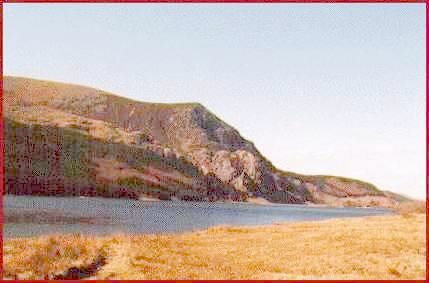
The line then continued on an embankment towards Lake Quellyn, leaving the river bank and swinging left through a shallow cutting and passing under the main road again. Here a wide, shallow cutting denoted the site of the first temporary terminus of the North Wales Narrow Gauge in 1877. The line then climbs at 1 in 67 following the contours of the land above the lake until it reached Quellyn Lake, latterly Snowdon Ranger, Station (7 1/4 miles). Here was a small stone station building, today converted into a cottage, a water tower and a siding. Below it, alongside the road, stood the former Snowdon Ranger Hotel from which it eventually took its name, today in use as a youth hostel.

The line continued to climb and crossed the Afon Treweunydd gorge on an impressive 100ft span girder bridge, 58 feet above the river. After a cutting, the line ran along a shelf supported by a high stone wall to reach Glanrafon Slate Quarry which closed during the First World War. Here an incline with double tracks ran down at right angles to the main line with a weighbridge at the bottom of the incline and several sidings for the storage of slate wagons until they were collected by the railway.
After a series of sinuous curves, climbing at 1 in 47, the railway traversed a sharp reverse curve to enter South Snowdon Station (9 1/4 miles) (also known as Snowdon or Rhyd-Ddu (pronounced 'Rid-Thee') during the life of the Railway). As befitted what was once the terminus of the North Wales Narrow Gauge, the brick and stone station buildings were somewhat larger than those on the rest of the line. Part of the station building also served as a signal box. There was a wooden refreshment hut and a goods shed, a long passing loop and two sidings. From the site of the station, 626 ft above sea level, an extensive panorama of mountain scenery can be observed. The summit of Snowdon, 3 1/4 miles distant, stands out prominently, with its mountain rack railway train from Llanberis to be seen making its ascent on a clear day. The station site today is a car park provided for those who wish to walk up the Rhyd-Ddu track to the top of Snowdon - in a strange way almost retaining part of the former purpose, as a set down place for railway passengers wishing to attempt the same walk.
South Snowdon - Beddgelert
Climbing again at 1 in 100 and then 1 in 50, the line followed the road to Pitts Head Halt (10 1/4 miles), the summit of the line at 647 feet above sea level. The line then passed under the road
and commenced the long descent at 1 in 40, following the hillside in a series of curves, passing Hafod Ruffyn Halt (12 1/4 miles) and shortly afterwards curving anticlockwise to bring it back below Hafod Ruffyn. The line now ran back across open countryside as though it was returning to Rhyd-Ddu, before entering another 180 degree curve which started with a cutting and ended on a high embankment above Afon Colwyn on its left. Falling at 1 in 40 and carried partly through cuttings, partly on embankments, the line crossed the Afon Meillionen and shortly afterwards entered a long curve which carried it over the Afon Cwm-Cloch on a 10ft girder bridge. The curve reversed again and the line entered a deep cutting. Leaving this, the another curve was built on a high embankment and there followed a shallow cutting in which the line again crossed the Afon Cwm-Cloch before curving left again. After crossing the Afon Cwm-Cloch for the third time, the railway entered Beddgelert Station (13 3/4 miles). In this latter section, there are many sections of the Portmadoc, Beddgelert and South Snowdon Railway earthworks, unused when the Welsh Highland was built, which can cause considerable confusion to anyone trying to trace the route. Indeed there appear to be two lines entering Beddgelert Station.
Beddgelert - Nantmor

Beddgelert Station was well equipped with a long passing loop and three sidings. The Station building and the goods shed were of corrugated iron construction. There was a water tower which is still visible from the car park below the station site, a small hut used as a store and one of the sidings had a short inspection pit.
Leaving the station, the line continued to descend at 1 in 40, passing through a cutting into a 40 yard long tunnel at the rear of the Royal Goat Hotel. It emerged on an embankment alongside the Beddgelert to Tremadoc road. Here the Portmadoc Beddgelert and South Snowdon intended to curve the line to the left and take it across the overbridge and along an embankment which would fall away to cross the river. The embankmebt was only partially built and the strange stone constructions along its line to the river would have formed an underbridge to provide the farmer, who's land the embankment would have crossed, with access from one part of his land to the other.
The actual course taken continued alongside the road, gradually losing height until the line passed under the road where the road bends. Immediately, the line crossed the Afon Glaslyn at Bryn-y-Felin on a 75ft span steel laticce girder bridge.
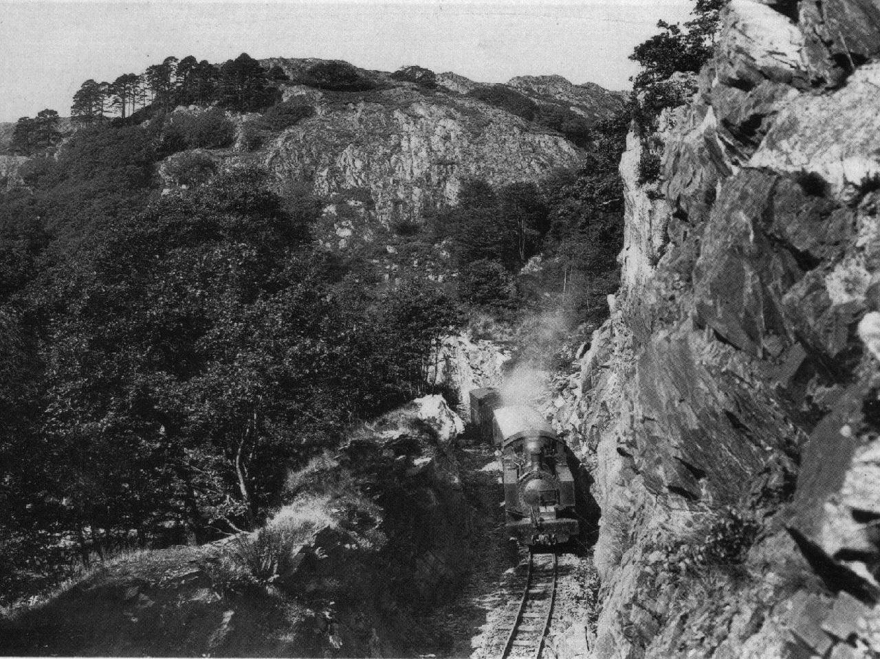
The line curved sharply and now ran alongside the river, climbing up above it at 1 in 80 on an embankment and through two short tunnels of 37 yards and 17 yards to emerge on a ledge high above the river. This commanded a magnificent view of the Aberglaslyn Pass.
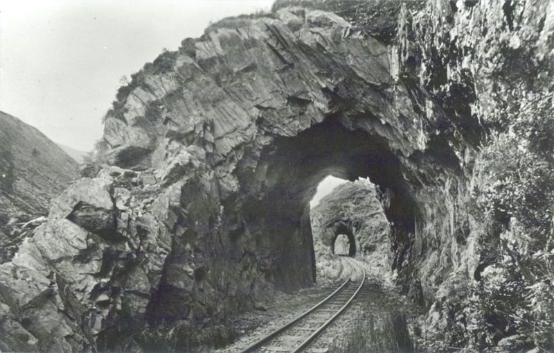
The line then entered the 300 yard long Aberglaslyn Tunnel. It is interesting to note that all three of these tunnels were built to standard gauge dimensions. Emerging from the third tunnel, the line crossed a high embankment then plunged into a rock cutting and crossed the Nantmor road on the level to reach Nantmor Station (15 1/2 miles). Here was a short siding and a corrugated iron passenger shelter.
Nantmor - Portmadoc
The line then continued on a shelf above the Llanfrothen road, descending at 1 in 40 before passing through a cutting and crossing the Llanfrothen road by a steel girder bridge. Continuing on an embankment, the line fell at 1 in 50, then1 in 250 to reach Hafod-y-Llyn Halt (16 1/4 miles). A wooded area was then skirted before the line crossed the Afon Nantmor on a 75 ft lattice girder bridge to reach Hafod Garregog Halt (17 1/4 miles), where an old railway carriage was provided to act as a passenger shelter. Almost immediately after the halt, the Afon Dylif was crossed by another lattice girder bridge. After a straight stretch of about half a mile, the line curved sharply right to make a junction with the Croesor Tramway at Croesor Junction (18 miles) where another old railway carriage served as a shelter.
The line then continued to Ynysfor Halt (18 1/4 miles) where there waas a short siding and two small huts of timber and zinc. It then ran parallel to and alongside the Llanfrothen - Prenteg road on a low embankment, until the Afon Glaslyn was reached. Here stood a water tank mounted on sleepers. The line crossed the Afon Glaslyn on a steel girder bridge of eight 24 foot spans on masonry piers.
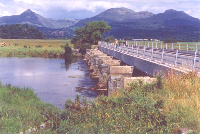
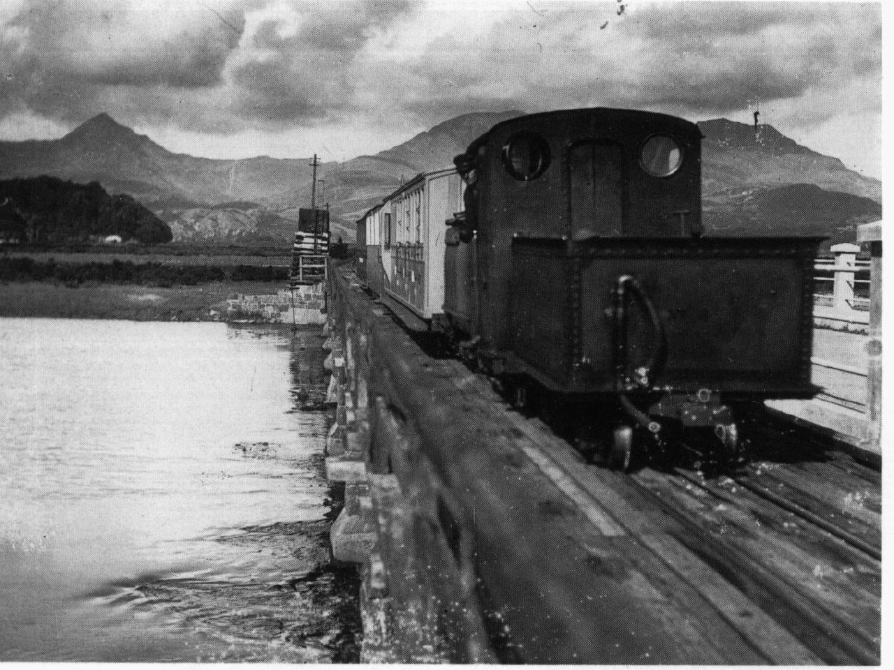
The piers still stand alongside the road bridge. Immediately, road and rail crossed on the level and there followed Pont Croesor Halt (19 3/4 miles) where another small hut of timber and zinc was provided for passengers.
The line then ran across the flat lands of the estuary on a low embankment, crossing a minor road on the level, running past Pen-y-Mount farm and alongside Beddgelert Siding. Here a transhipment bay was provided with the standard gauge. It is Beddgelert Siding that the Welsh Highland Light Railway (1964) Ltd. have made their base and run their present services whilst preparing to head northwards along the old track as soon as circumstances permit.
Portmadoc
Portmadoc New (1933) station (21 miles) was then reached. This had a simple corrugated iron shelter. The line then crossed the Cambrian Caost railway on the level and ran onto an embankment to reach Portmadoc New (1923) station (21 1/4 miles). The corrugated iron station building (which survived in derelict form until 1994, when it was destroyed by arsonists) and wooden refreshment room were situated in a filed below the embankment and reached by a flight of steps down the embankment. There was also a lengthy crossing loop and a water tower - the base of which still survives. This was ther terminus of Welsh Highland Railway passenger services, unless you happened to be on a train running through onto the Ffestiniog Railway.
Leaving Portmadoc New (1923) station and still on the embankment, the line crossed Y Cyt canal by a stone bridge and passed a flour mill (now Porthmadog Pottery) on the left. Here was a short siding and covered loading platform. Beyond this point, another siding on the right, running over what had previously been the Gorseddau Tramway, joined the line at the spot where the Gorseddau and Croesor Tramways had linked, running from a slate works. The line then crossed Snowdon Street on the level and made a wide curve, passing the Glaslyn Foundry and entering Madoc Street. Here the line split. To the left the line crossed the High Street on the level and continued over Brittania Bridge and into Harbour Station (22 miles from Dinas Junction). This portion of the line was Ffestiniog Railway property however. To the right it crossed the High Road, again on the level, and entered the slate wharves alongside the harbour.
See also Ben Fisher's description of the route in the 1990's.

